Map of Iceland — 105 places to visit
An interactive map of 105 places to visit in Iceland — waterfalls, hot springs, glaciers, beaches and towns — with every location plotted, filterable by region, and linked to a full guide.
Every place below sits on the map above with its exact coordinates. Filter by region to plan a single leg of a trip, or open any place for photos, driving distances and current conditions.
South Iceland — 30 places on the map
The busiest stretch of the map and the one most trips start with: the Golden Circle loop inland, then the south coast run past Seljalandsfoss, Skógafoss, Reynisfjara and on to Jökulsárlón.
- Diamond Beach — A practical guide to visiting Diamond Beach on Iceland's South Coast, focusing on the mech...
- Dyrholaey — A practical look at visiting Dyrholaey, from navigating the upper and lower parking areas...
- Fjadrargljufur — Carved by glacial runoff over nine millennia, Fjadrargljufur is a 100-meter deep corridor...
- Fjallsarlon — Located just 10 kilometers west of its famous neighbor, Fjallsarlon offers a more containe...
- Geysir Geothermal area — Discover the raw, explosive power of nature at Geysir Hot Spring in Iceland's Haukadalur V...
- Gljufrabui — A few hundred meters from the grand theater of Seljalandsfoss lies a waterfall concealed w...
- Gullfoss — A double-tiered glacial waterfall where the Hvita river plunges into a deep gorge, Gullfos...
- Haifoss — Dropping 122 meters into a deep volcanic canyon, Haifoss and its neighbor Granni offer a p...
- Jokulsarlon — Jokulsarlon is a tidal lagoon where massive icebergs drift from the Breidamerkurjokull gla...
- Kerid Crater — Located in the Grimsnes area of South Iceland, Kerid Crater is a 3,000-year-old volcanic c...
- Kvernufoss — Located just east of Skogafoss, Kvernufoss provides an intimate experience within a moss-c...
- Oxararfoss waterfall — Öxarárfoss is a waterfall in UNESCO-listed Þingvellir National Park, where the Öxará River...
- Reynisfjara — Encounter the dramatic landscape of Iceland’s most famous black sand beach, where volcanic...
- Seljalandsfoss waterfall — Follow the mist along the ancient Atlantic cliffs of South Iceland to experience Seljaland...
- Seljavallalaug — Built in 1923, Seljavallalaug is one of Iceland’s oldest pools. Tucked away in a valley on...
- Skaftafell — A wilderness area in Southeast Iceland where lush birch forests meet the massive outlet gl...
- Skogafoss waterfall — A guide to experiencing the monumental scale and sensory power of Skogafoss, including the...
- Solheimajokull — An accessible glacier outlet of the Myrdalsjokull ice cap, Solheimajokull offers a firstha...
- Solheimasandur Plane Wreck — Beyond the popular photos lies a story of survival, a case of mistaken identity, and a lon...
- Thingvellir — Discover Thingvellir National Park, a UNESCO World Heritage site where tectonic plates dri...
- Thorsmork — Thorsmork exists as an ecological island, shielded by three glaciers and defined by the sh...
- Vik — Vik i Myrdal serves as a vital hub on the South Coast, offering a landscape of basalt colu...
- Akratorg — A paved town square in central Akranes defined by its open space and a bronze memorial ded...
- Arnarstapi — Á Arnarstapa eru fallegir klettar og fjölbreytt fugla- og dýralíf (1). Ströndin milli Arna...
- Djúpalónssandur — Djúpalónssandur er skemmtileg malarvík með ýmsum furðulegum klettamyndunum. Þar eru fjórir...
- Hellnar — Hellnar er fornt sjávarpláss um 3 km fyrir vestan Arnarstapa. Hellnar voru ein af stærstu...
- Kirkjufellsfoss — Kirkjufellsfoss er staðsettur rétt sunnan við þjóðveginn en þaðan er hvað best útsýni yfir...
- Lakagígar — „Lakagígar eru stórfengleg 25 km löng gígaröð á Síðumannaafrétti. Liggur hún frá móbergsfj...
- Vestmannaeyjar islands — A cluster of islands forged by fire, Vestmannaeyjar offers a window into Iceland's volcani...
- Ytri Tunga — Ytri Tunga er á sunnanverðu Snæfellsnesi um 15 km áður en komið er að Búðum (1). Þar er ná...
East Iceland — 9 places on the map
The eastfjords: switchback roads between sea and mountain, reindeer country, and the quiet approach to Vatnajökull from the far side.
- Faskrudsfjordur — Explore Faskrudsfjordur, a town where bilingual street signs and a restored French hospita...
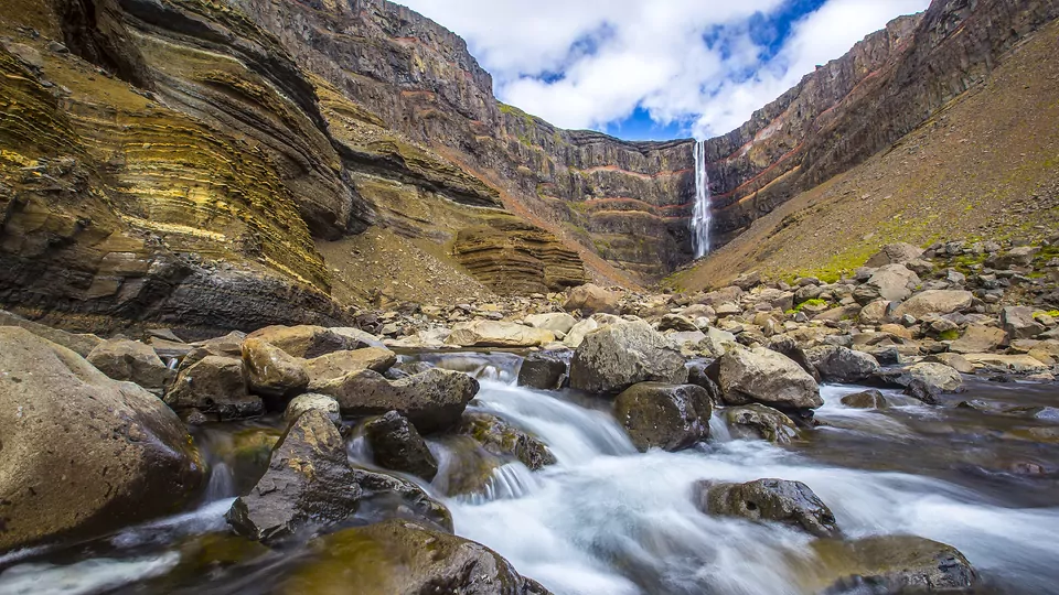
- Hengifoss — Located near Egilsstadir, Hengifoss is one of Iceland's tallest waterfalls, famous for its...
- Stokksnes — An exploration of the Stokksnes peninsula in East Iceland, focusing on the geological prom...
- Borgarfjordur eystri — Beyond the paved mountain pass from Egilsstadir lies a village where colorful mountains me...
- Djúpivogur — In a corner of the Eastfjords where the pace is intentionally slow, Djupivogur offers a re...
- Egilsstadir — A functional 20th-century hub that offers a different side of Iceland, from warmer summer...
- Hallormsstaðaskógur — While Iceland is often known for its barren landscapes, Hallormsstadaskogur offers a dense...
- Seyðisfjörður — Beyond the scenic mountain pass of Fjardarheidi lies a town where historic Norwegian timbe...
- Studlagil — Once hidden beneath the silty depths of a powerful glacial river, Studlagil has emerged as...
West Iceland — 14 places on the map
Snæfellsnes and Borgarfjörður — a glacier-topped volcano, black churches, lava caves and waterfalls, close enough to Reykjavík for a long day out.
- Hraunfossar — Witness a rare geological phenomenon where glacial water filters through porous rock and p...
- Akrafjall Mountain — Hike this flat-topped mountain in West Iceland for views stretching from the Reykjanes Pen...
- Akranes — Beyond the tunnel north of Reykjavik, Akranes reveals a landscape of rare golden beaches,...
- Barnafoss — Barnafoss presents a visceral display of the Hvita River’s strength, where churning turquo...
- Borgarnes — Situated where the long bridge crosses Borgarfjordur, Borgarnes is a place of deep history...
- Deildartunguhver — Deildartunguhver er vatnsmesti hver Evrópu en úr honum renna 180 lítrar af 100°C heitu vat...
- Húsafell — „Á Húsafelli sat séra Snorri Björnsson (1710-1803) og hafa um hann spunnist fjölmargar þjó...
- Kirkjufell mountain — A practical guide to visiting Kirkjufell, covering the best photography angles, geological...
- Langjökull Glacier — Spanning nearly a thousand square kilometers in the western highlands, Langjokull provides...
- Reykholt — „Í Reykholti bjó Snorri Sturluson (1178-1241), einn nafnkunnasti höfundur, skáld og fræðim...
- Snaefellsjokull Glacier — A crown of ice atop an ancient stratovolcano, Snaefellsjokull is a landmark of literary le...
- Snorralaug — Laugin er kennd við Snorra Sturluson sem var uppi 1179-1241 en í Landnámu segir þó að laug...
- Stykkisholmur — A historic fishing town on the Snaefellsnes Peninsula, Stykkisholmur is defined by its vib...
- Vidgelmir Cave — Descend into one of the world's largest lava tubes, where illuminated walkways reveal a ma...
North Iceland — 18 places on the map
Akureyri, Mývatn and the Diamond Circle — Goðafoss, Dettifoss and Ásbyrgi — plus the whale-watching towns on the north coast.
- Asbyrgi — A massive geological depression in the Oxarfjordur region, Asbyrgi features 100-meter clif...
- Godafoss — A geological and historical landmark where the Skjalfandafljot river drops over a basalt h...
- Myvatn — A detailed guide to the geological formations, unique bird species, and geothermal culture...
- Akureyri — Situated at the base of Iceland's longest fjord, Akureyri serves as the primary hub of the...
- Aldeyjarfoss — „Aldeyjarfoss er einn af áhugaverðari fossum landsins, staðsettur við norðurenda Sprengisa...
- Arctic Henge — Journey to the remote Melrakkasletta Peninsula to encounter a massive stone complex design...
- Dalvik — From the gateway to the Arctic Circle to the slopes of the Troll Peninsula, Dalvik offers...
- Dettifoss waterfall — Located in the rugged heart of North Iceland, Dettifoss is a spectacle of raw energy, plun...
- Dimmuborgir — A sprawling field of jagged lava pillars and volcanic caves, Dimmuborgir offers a landscap...
- Grjótagjá — Laugin er staðsett í gjá í nokkurskonar helli. Í þakinu eru stór björg sem sum virðast ver...
- Húsavík — Discover Húsavík, a charming northern town famous for world-class whale watching, restorat...
- Hvítserkur — „Hvítserkur er einn sérstæðasti klettadrangurinn við Ísland og rís hann um 15 metra hár í...
- Keflavík — Keflavík er afskekkt vík í Fjörðum á Flateyjarskaga, milli Eyjafjarðar og Skjálfandaflóa....
- Krafla — „Jarðhitasvæðið í Kröflu er í gamalli öskju sem er næstum fyllt upp á barma af móbergi og...
- Myvatn Nature Baths — Located in the heart of the Myvatn region, these alkaline baths offer a mineral-rich soak...
- Námafjall — Namafjall and the Hverir geothermal field offer a raw encounter with the earth’s interior,...
- Ólafsfjörður — A refined exploration of Olafsfjordur, where rare ecological phenomena and dramatic mounta...
- Siglufjörður — Once the herring capital of the North Atlantic, Siglufjörður is now a refined cultural out...
Reykjavik & Capital Area — 11 places on the map
The capital and everything within an easy morning of it — the city itself, Mount Esja, and the harbour towns along the bay.
- Hallgrímskirkja — Rising above the rooftops of Reykjavik, Hallgrimskirkja is more than a place of worship; i...
- Reykjavik — Reykjavik combines high-latitude architecture with a compact city center, serving as the c...
- Alftanes — Located a short drive from Reykjavik, Alftanes offers rich birdwatching on tidal mudflats,...
- Ásfjall — „Ásfjall ofan við Hafnarfjörð er hæst 127 m.y.s. Ásfjall er í raun grágrýtishæð. Fjallið e...
- Harpa — „Harpa er eitt helsta kennileiti Reykjavíkur og er miðstöð menningar og mannlífs í hjarta...
- Laugavegur — Laugavegur is Reykjavik’s primary corridor for shopping, dining, and nightlife. From its h...
- Nautholsvik — Nautholsvik Geothermal Beach offers a rare chance to swim in the North Atlantic waters, te...
- Perlan — Þegar endurnýja þurfti vatnsgeymana á Öskjuhlíð var ákveðið byggja þar útsýnishús. Ingimun...
- Reykjavik Old Harbor — Once the industrial engine of the capital, the Old Harbor has evolved into a vibrant distr...
- Sólfarið — Við Sólfarið í Reykjavík er vinsælt að njóta útsýnis og taka myndir. Sólfarið er staðsett...
- Viðey — Viðey er stærsta eyjan í Kollafirði en hún skiptist í tvo hluta sem eru tengdir með mjóu e...
Reykjanes Peninsula — 7 places on the map
The peninsula you land on. Lava fields, the Blue Lagoon, geothermal steam and the recent eruption sites, all within 40 minutes of Keflavík airport.
- Fagradalsfjall — Scale the ridges of the Reykjanes Peninsula to witness where the earth split open. Fagrada...
- Seltun — A landscape of boiling mud pots and hissing steam vents, Seltun offers a window into the v...
- The Blue Lagoon — Located within the rugged lava fields of the Reykjanes Peninsula, the Blue Lagoon offers a...
- Bridge Between Contintents — Stand between tectonic plates at this symbolic bridge on the Reykjanes Peninsula, where th...
- Gunnuhver — „Rétt austan við Reykjanesvita er mikið jarðhitasvæði, eitt af mörgum á Reykjanesi. Gunnuh...
- Kleifarvatn — Discover the dramatic shores of Kleifarvatn, a deep volcanic lake shaped by earthquakes an...
- Reykjanes Lighthouse — Standing atop the windswept Baejarfell hill, Reykjanesviti guards the treacherous waters o...
The Highlands — 5 places on the map
The interior, open only in summer and mostly only to modified vehicles. Landmannalaugar, Askja and the tracks between them.
- Kerlingarfjoll — A technical guide to the Kerlingarfjoll highlands, focusing on the transition from a defun...
- Landmannalaugar — A high-altitude landscape of rhyolite mountains, obsidian lava fields, and geothermal rive...
- Askja — Penetrate the remote interior of Iceland to reach Askja, a massive volcanic caldera where...
- Hveradalir — A logistical guide to visiting Hveradalir, a high-altitude geothermal valley in Iceland's...
- Hveravellir — „Hveravellir hafa um aldir verið áningarstaður ferðalanga um Kjöl“ (1). Þar er eitt af stæ...
Westfjords — 11 places on the map
The remotest driving in the country. Fjord after fjord, Dynjandi, the Látrabjarg bird cliffs and roads that empty out completely.
- Dynjandi — A massive trapezoidal waterfall and a series of seven distinct cascades in the remote West...
- Latrabjarg — Latrabjarg stands as one of Europe's largest bird cliffs, offering a remote and rugged loo...
- Bolungarvík — Located at the northern edge of the Westfjords, Bolungarvik combines deep-rooted fishing t...
- Drangsnes — A small fishing village on the Strandir coast, Drangsnes is defined by its shoreline hot t...
- Flateyri — On a narrow sandspit beneath towering table-top mountains, Flateyri offers a glimpse into...
- Hólmavík — Holmavik is the largest settlement in the remote Strandir region, known for its deep conne...
- Hornstrandir — Deep in the northernmost corner of the Westfjords lies Hornstrandir, a vast nature reserve...
- Ísafjörður — Isafjordur serves as the primary gateway to the Westfjords, balancing its role as a functi...
- Krossneslaug — Krossneslaug er steinsteypt útisundlaug við fjöruborðið, fáeina kílómetra frá Norðurfirði...
- Rauðisandur — „Rauðisandur við Breiðafjörð er ein afskekktasta sveit á Íslandi en jafnframt einhver sú f...
- The old bookstore Flateyri — Iceland's oldest original shop is more than a place to browse; it is a meticulously preser...
Browse all destinations · Live weather across Iceland · Driving distances
One of them, with the sound on
Step inside the East Iceland and the Eastfjords — 8 stops, narrated, free.