Thorsmork: A glaciated sanctuary and the resilience of the Icelandic birch
Thorsmork
Weather
Local Time
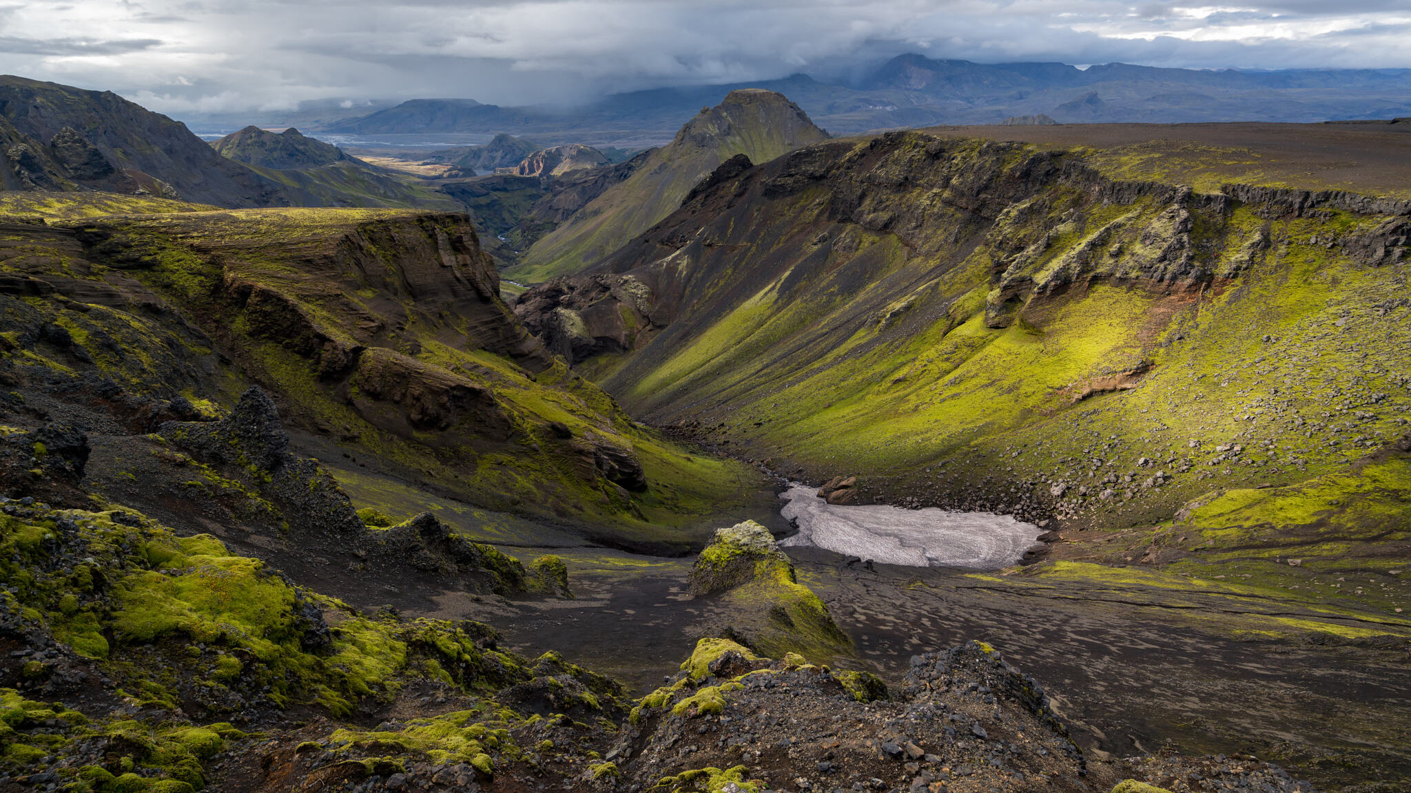
Thorsmork exists as an ecological island, shielded by three glaciers and defined by the shifting currents of the Krossa River, offering a rare glimpse into Iceland's pre-settlement landscape.
Þórsmörk (Thórsmörk) is a natural gem that sits between Mýrdalsjökull to the east, the river Krossá in the south, with Markárfljót and Þröngá Rivers to the north. Its diverse landscape is characterized by impressive gorges, ravines, scrubby slopes, and a wide variety of unique vegetation. In times past, the farmers of Fljótshlíð and the area under Eyjafjall pastured their sheep all year round due to the mild climate found within þórsmörk. Since the 1918 eruption of Katla, Þórsmörk was designated as a Natural Mountain Reserve. There are many curious natural rock formations in the area, such as Snorraríki, Sóttarhellar Cave, Álfakirkja (The Church of the Elves), Stakkholtsgjá Gorge, and the stone arch in Stóra Enda. Only large jeeps and buses can navigate the road into Þórsmörk due to the ever-changing volume of water, which can turn small and easily passable tributaries into tumultuous rivers in a matter of hours.
„Þórsmörk er þekkt útivistarparadís á Suðurlandi og vinsæll ferðamannastaður.“ Leiðin þangað er örlítið torfær og góður jeppi er því nauðsynlegur en ferðalagið er vel þess virði. „Svæðið er stórbrotið með fjölbreyttu landslagi og ævintýralegum skógi - þeim sem kemst næst náttúrulegum birkiskógi hér á landi. Skálar og tjaldsvæði eru í umsjón ferðafélaga.“ Víða um svæðið eru merktir göngustígar og suðurendi Laugavegarins er í Þórsmörk. Á svæðinu kemur glögglega fram merkur árangur beitarfriðunar og hvernig sjálfboðavinna hefur skilað sér í uppgræðslu undanfarna áratugi. Þórsmörk, or the "Valley of Thor," is a majestic mountain ridge nestled between the glaciers Tindfjallajökull, Eyjafjallajökull, and Mýrdalsjökull in southern Iceland. It is a place of dramatic contrasts, where jagged peaks, lush birch forests, and braided glacial rivers collide. While many visitors come for the world-class hiking, the true essence of Þórsmörk lies in its hidden geological secrets and its reputation as a sanctuary that feels fundamentally different from the rest of the island. The Sanctuary of the Thunder God Geologically, Þórsmörk is a ridge created by the movement of glaciers and the volcanic activity surrounding it. It is protected by three glaciers, which create a unique microclimate. While the rest of the south coast might be battered by rain and wind, Þórsmörk often remains strangely calm and sunny, allowing for the growth of lush vegetation, including mountain ash and birch forests, which are a rarity in Iceland's largely treeless landscape. What People Often Comment About The "Greenness": Almost every visitor is struck by how lush and green the valley is compared to the stark black deserts and mossy lava fields they’ve seen elsewhere in Iceland. The River Crossings: The drive into Þórsmörk is famous (and infamous) for its river crossings, particularly the notorious Krossá River. Travelers often comment on the thrill—or terror—of watching modified "Super Jeeps" navigate deep, fast-moving glacial waters. The Hiker's Paradise: It is frequently cited as the finishing point of the Laugavegur trail and the starting point for the Fimmvörðuháls hike. People often comment on the sense of achievement and the "hiker culture" found at the mountain huts like Básar or Langidalur. The Views from Valahnúkur: The 360-degree view from the top of Valahnúkur mountain is one of the most shared images of the region, showing the braided rivers winding through the valley below. What is True, But Not Often Mentioned Beyond the hiking trails, there are several factual aspects of Þórsmörk that remain "hidden in plain sight." 1. It is a "Volcanic Island" Surrounded by Ice While it’s not an island in the ocean, Þórsmörk is essentially an island of land surrounded by ice. This isolation is what preserved its unique flora. Because the glaciers acted as a barrier, the sheep grazing that decimated forests in other parts of Iceland was much more restricted here. This makes Þórsmörk one of the most authentic representations of what Iceland looked like before human settlement. 2. The Krossá River is "Alive" and Moves People talk about the Krossá as a challenge to cross, but few realize it is a "wandering" river. Its bed is made of loose volcanic silt and gravel, meaning the deepest part of the river can shift by several meters in a single day. This is why there are no permanent bridges for cars; the river would simply move around them. Instead, there are mobile bridges on wheels for hikers that rangers move daily to span the deepest channels. 3. The 2010 Eruption Literally Changed the Valley When Eyjafjallajökull erupted in 2010, Þórsmörk was covered in a thick layer of grey volcanic ash. Many feared the "green valley" was gone forever. However, the ash actually acted as a fertilizer. Today, the vegetation is more vibrant than ever. Visitors often walk over "new ground" without realizing that the valley floor was raised by several meters of ash and debris during that event. 4. The Hidden "Secret" Canyon: Stakkholtsgjá While people focus on the ridges, the deep canyon of Stakkholtsgjá is a geological masterpiece that is often overlooked by those in a hurry. The canyon walls rise 100 meters high, and it terminates in a hidden waterfall that requires wading through a small stream to see. It feels like a scene from Lord of the Rings, but because it is at the entrance of the valley, many people drive right past it. What Surprises Visitors Most The Sound of the "Moving" Mountains: On quiet days, visitors are often surprised by the soundscape. You can hear the constant "crack" and "boom" of the surrounding glaciers moving, as well as the sound of rocks tumbling down steep scree slopes. It is a landscape that sounds as active as it looks. The Complexity of the Bus Ride: Most people realize they shouldn't drive a rental car there, but they are surprised by the specialized mountain buses. These buses have massive tires and high air intakes, and watching them "swim" through a river is a spectator sport in itself. The "Luxury" in the Wild: Many expect primitive camping, but are surprised by Volcano Huts in Húsadalur, which offers glamping, a sauna, a restaurant, and even craft beer. Finding a hot shower and a gourmet meal in a valley surrounded by three glaciers is a major "wow" factor for many. The Verticality: Maps don't do justice to the steepness. Visitors are often surprised by how quickly the trails ascend. You can go from a lush forest to a jagged, snow-capped ridge in less than 40 minutes of hiking. Practical Factual Tips Access: Never attempt to drive a standard 2WD or even a small 4WD rental (like a Dacia Duster) into Þórsmörk. The Krossá River destroys multiple vehicles every summer. Use the Highland Bus or a Super Jeep tour. Seasonality: The valley is generally accessible from mid-June to September. In winter, it is a specialized destination accessible only by modified vehicles on "Snow Tours." Hiking Safety: The weather in Þórsmörk can change in minutes. Even if it’s sunny in the valley, the ridges can be covered in "fog" (low clouds) that makes navigation dangerous.
„Þórsmörk er þekkt útivistarparadís á Suðurlandi og vinsæll ferðamannastaður.“ Leiðin þangað er örlítið torfær og góður jeppi er því nauðsynlegur en ferðalagið er vel þess virði. „Svæðið er stórbrotið með fjölbreyttu landslagi og ævintýralegum skógi - þeim sem kemst næst náttúrulegum birkiskógi hér á landi. Skálar og tjaldsvæði eru í umsjón ferðafélaga.“ Víða um svæðið eru merktir göngustígar og suðurendi Laugavegarins er í Þórsmörk. Á svæðinu kemur glögglega fram merkur árangur beitarfriðunar og hvernig sjálfboðavinna hefur skilað sér í uppgræðslu undanfarna áratugi. Þórsmörk, or the "Valley of Thor," is a majestic mountain ridge nestled between the glaciers Tindfjallajökull, Eyjafjallajökull, and Mýrdalsjökull in southern Iceland. It is a place of dramatic contrasts, where jagged peaks, lush birch forests, and braided glacial rivers collide. While many visitors come for the world-class hiking, the true essence of Þórsmörk lies in its hidden geological secrets and its reputation as a sanctuary that feels fundamentally different from the rest of the island. The Sanctuary of the Thunder God Geologically, Þórsmörk is a ridge created by the movement of glaciers and the volcanic activity surrounding it. It is protected by three glaciers, which create a unique microclimate. While the rest of the south coast might be battered by rain and wind, Þórsmörk often remains strangely calm and sunny, allowing for the growth of lush vegetation, including mountain ash and birch forests, which are a rarity in Iceland's largely treeless landscape. What People Often Comment About The "Greenness": Almost every visitor is struck by how lush and green the valley is compared to the stark black deserts and mossy lava fields they’ve seen elsewhere in Iceland. The River Crossings: The drive into Þórsmörk is famous (and infamous) for its river crossings, particularly the notorious Krossá River. Travelers often comment on the thrill—or terror—of watching modified "Super Jeeps" navigate deep, fast-moving glacial waters. The Hiker's Paradise: It is frequently cited as the finishing point of the Laugavegur trail and the starting point for the Fimmvörðuháls hike. People often comment on the sense of achievement and the "hiker culture" found at the mountain huts like Básar or Langidalur. The Views from Valahnúkur: The 360-degree view from the top of Valahnúkur mountain is one of the most shared images of the region, showing the braided rivers winding through the valley below. What is True, But Not Often Mentioned Beyond the hiking trails, there are several factual aspects of Þórsmörk that remain "hidden in plain sight." 1. It is a "Volcanic Island" Surrounded by Ice While it’s not an island in the ocean, Þórsmörk is essentially an island of land surrounded by ice. This isolation is what preserved its unique flora. Because the glaciers acted as a barrier, the sheep grazing that decimated forests in other parts of Iceland was much more restricted here. This makes Þórsmörk one of the most authentic representations of what Iceland looked like before human settlement. 2. The Krossá River is "Alive" and Moves People talk about the Krossá as a challenge to cross, but few realize it is a "wandering" river. Its bed is made of loose volcanic silt and gravel, meaning the deepest part of the river can shift by several meters in a single day. This is why there are no permanent bridges for cars; the river would simply move around them. Instead, there are mobile bridges on wheels for hikers that rangers move daily to span the deepest channels. 3. The 2010 Eruption Literally Changed the Valley When Eyjafjallajökull erupted in 2010, Þórsmörk was covered in a thick layer of grey volcanic ash. Many feared the "green valley" was gone forever. However, the ash actually acted as a fertilizer. Today, the vegetation is more vibrant than ever. Visitors often walk over "new ground" without realizing that the valley floor was raised by several meters of ash and debris during that event. 4. The Hidden "Secret" Canyon: Stakkholtsgjá While people focus on the ridges, the deep canyon of Stakkholtsgjá is a geological masterpiece that is often overlooked by those in a hurry. The canyon walls rise 100 meters high, and it terminates in a hidden waterfall that requires wading through a small stream to see. It feels like a scene from Lord of the Rings, but because it is at the entrance of the valley, many people drive right past it. What Surprises Visitors Most The Sound of the "Moving" Mountains: On quiet days, visitors are often surprised by the soundscape. You can hear the constant "crack" and "boom" of the surrounding glaciers moving, as well as the sound of rocks tumbling down steep scree slopes. It is a landscape that sounds as active as it looks. The Complexity of the Bus Ride: Most people realize they shouldn't drive a rental car there, but they are surprised by the specialized mountain buses. These buses have massive tires and high air intakes, and watching them "swim" through a river is a spectator sport in itself. The "Luxury" in the Wild: Many expect primitive camping, but are surprised by Volcano Huts in Húsadalur, which offers glamping, a sauna, a restaurant, and even craft beer. Finding a hot shower and a gourmet meal in a valley surrounded by three glaciers is a major "wow" factor for many. The Verticality: Maps don't do justice to the steepness. Visitors are often surprised by how quickly the trails ascend. You can go from a lush forest to a jagged, snow-capped ridge in less than 40 minutes of hiking. Practical Factual Tips Access: Never attempt to drive a standard 2WD or even a small 4WD rental (like a Dacia Duster) into Þórsmörk. The Krossá River destroys multiple vehicles every summer. Use the Highland Bus or a Super Jeep tour. Seasonality: The valley is generally accessible from mid-June to September. In winter, it is a specialized destination accessible only by modified vehicles on "Snow Tours." Hiking Safety: The weather in Þórsmörk can change in minutes. Even if it’s sunny in the valley, the ridges can be covered in "fog" (low clouds) that makes navigation dangerous.
Where to go next
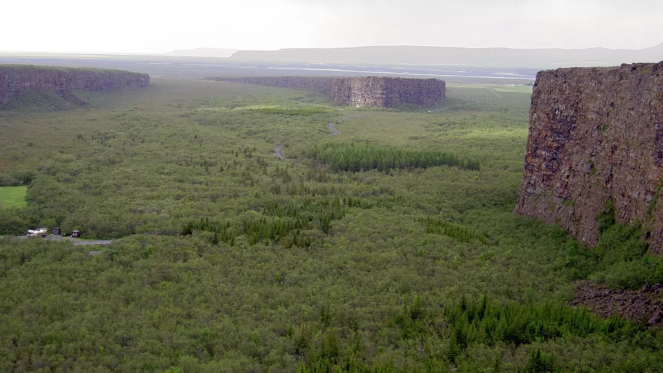
Next: Asbyrgi — 665 km, 554 minutes from Thorsmork, narrated.
Step inside a journey
Guided audio journeys across Iceland — every stop mapped, narrated and ready to drive.
7 stops
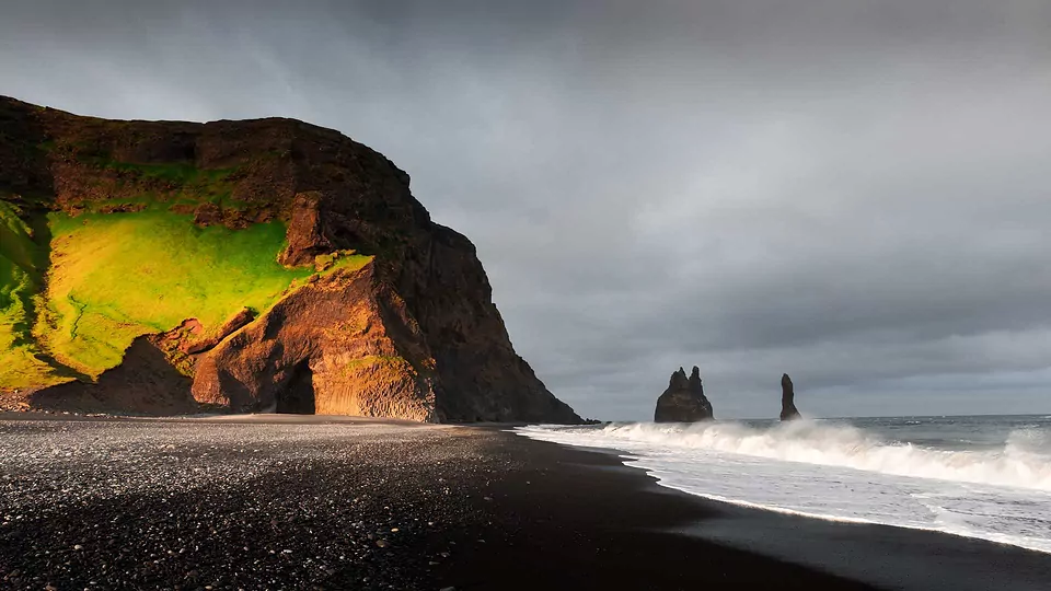
South Coast: Waterfalls and Black Sands
Follow Iceland’s best-known south coast landscapes, from powerful waterfalls to black sand beaches and sea cliffs.
Start journey →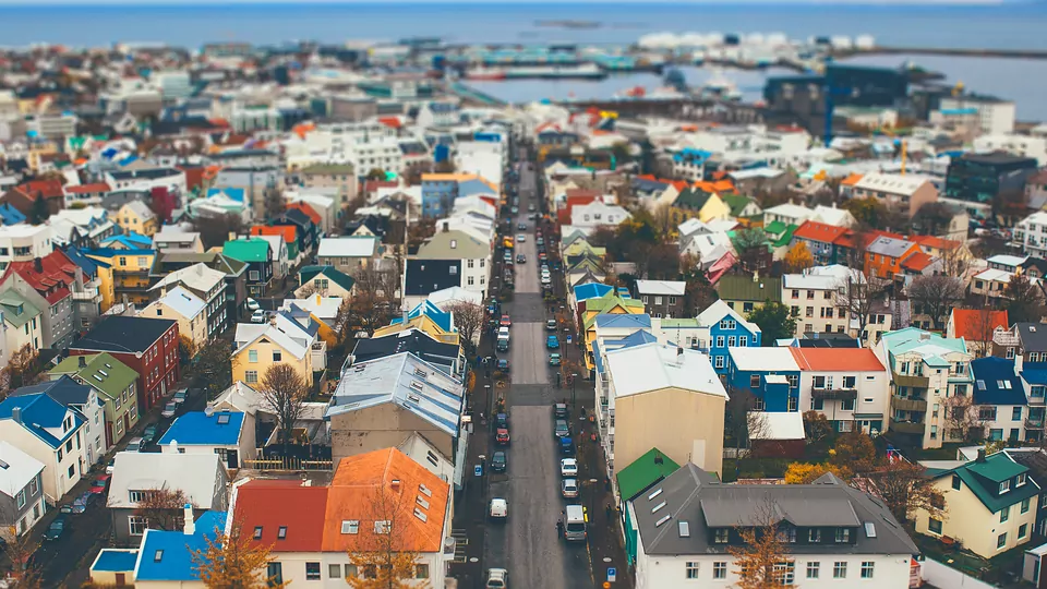
8 stops
Reykjavík: City by the Sea
Get to know Iceland’s capital through its landmarks, waterfront, culture, and everyday city atmosphere.d
Start journey →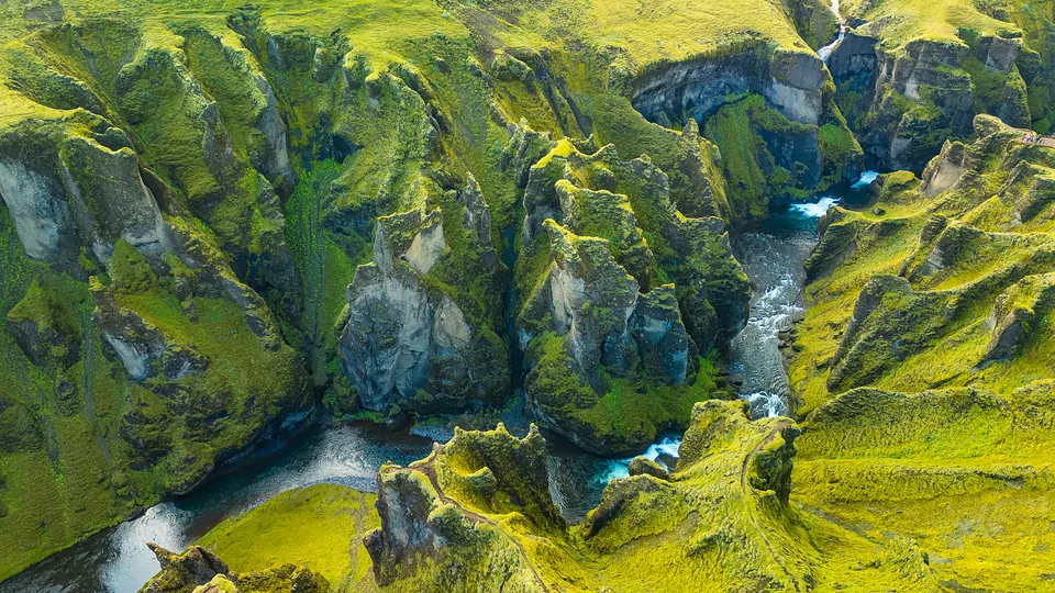
7 stops
South Iceland: Hidden Stops and Scenic Detours
Go beyond the classics with quieter stops, canyon views, and lesser-known corners of the south.
Start journey →